-All of the following photographs were taken by others, but unfortunately I do not have the sources. If these images belong to you, I mean no disrespect.
-All of the radar images were made by me using Unidata's IDV program with Level II NEXRAD data. Note that all my images are from a 4:08pm radar scan.

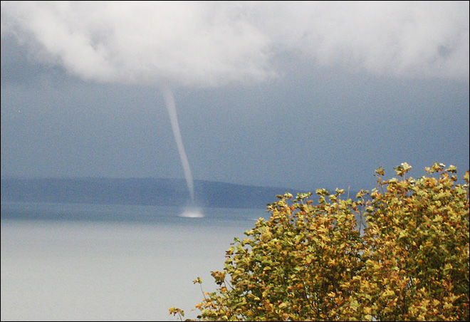
Here, the spout is roughly south of
the observer, who apparently is in a downpour.
This image is probably at about the
same time as the previous one, but looking basically north. It is likely the
photographer of the last image was located on the piece of land behind the
funnel in this picture.
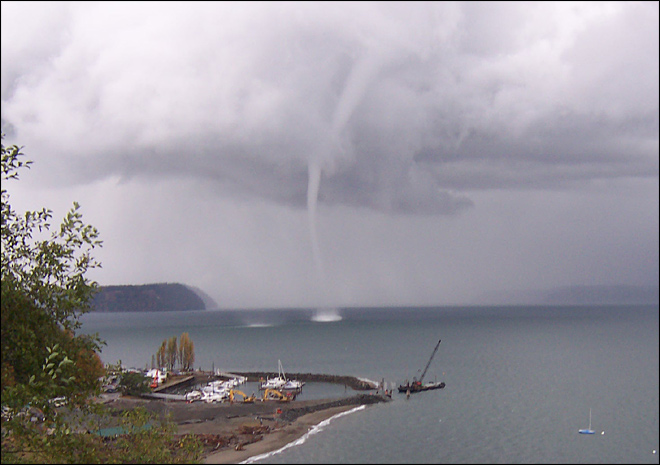
This is the best one. Notice how the
funnel can be seen extending up through the lowest level of clouds. Also, to
the left of the waterspout appears to be another one forming, as evidenced by
the disturbed water.
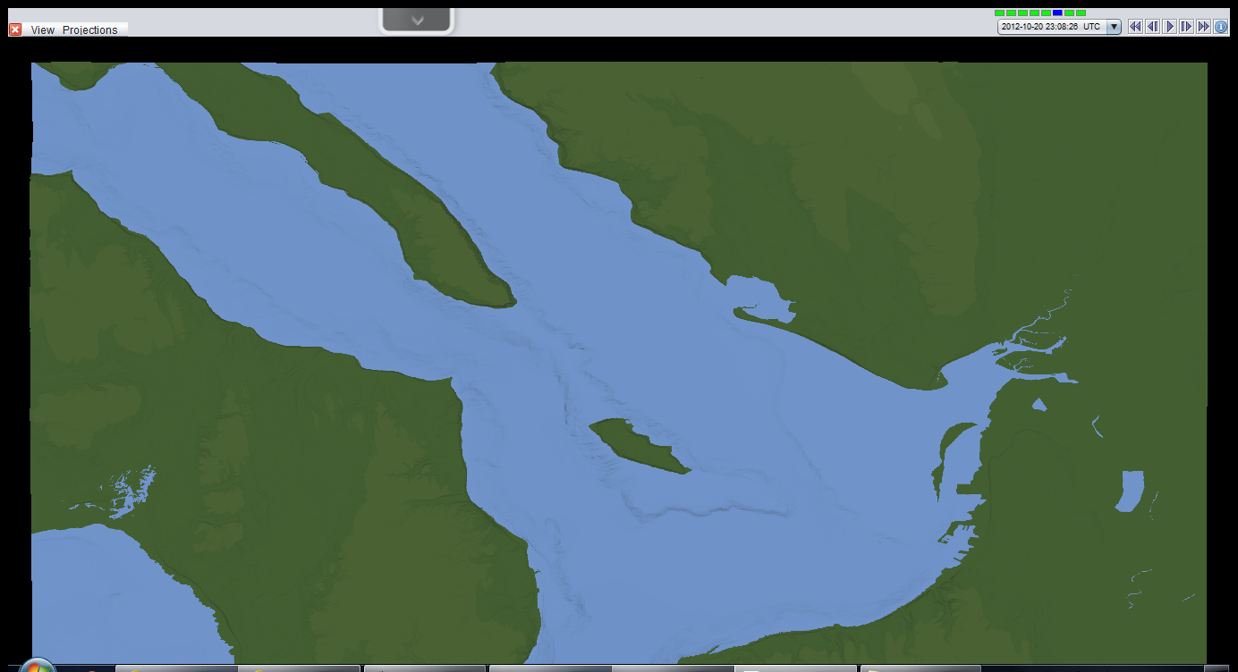
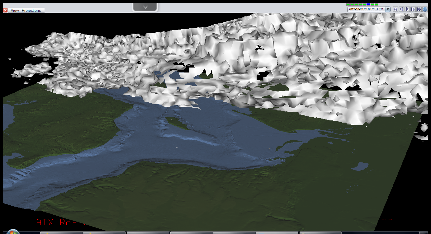
This is the topography map I used for
my images. The KATX radar is located just off the top left corner of the image
and Everett is located on the center right.
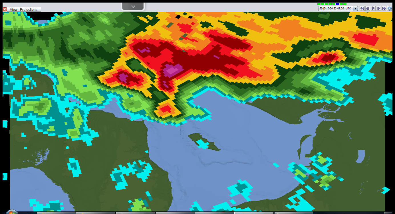
Here is the reflectivity data, like
what is often shown on the news. Notice the hook in the clouds just north of
the island, that is the general region I suspect the waterspout was.
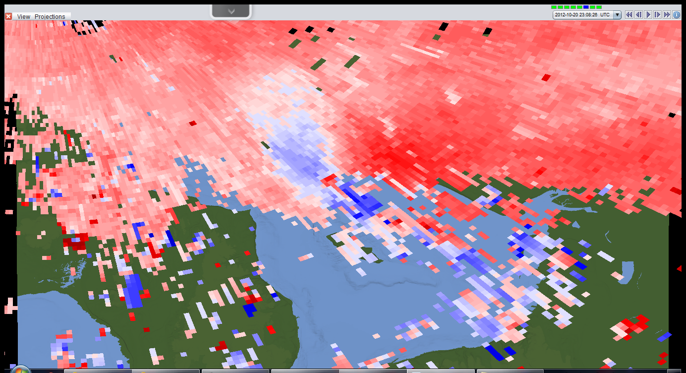
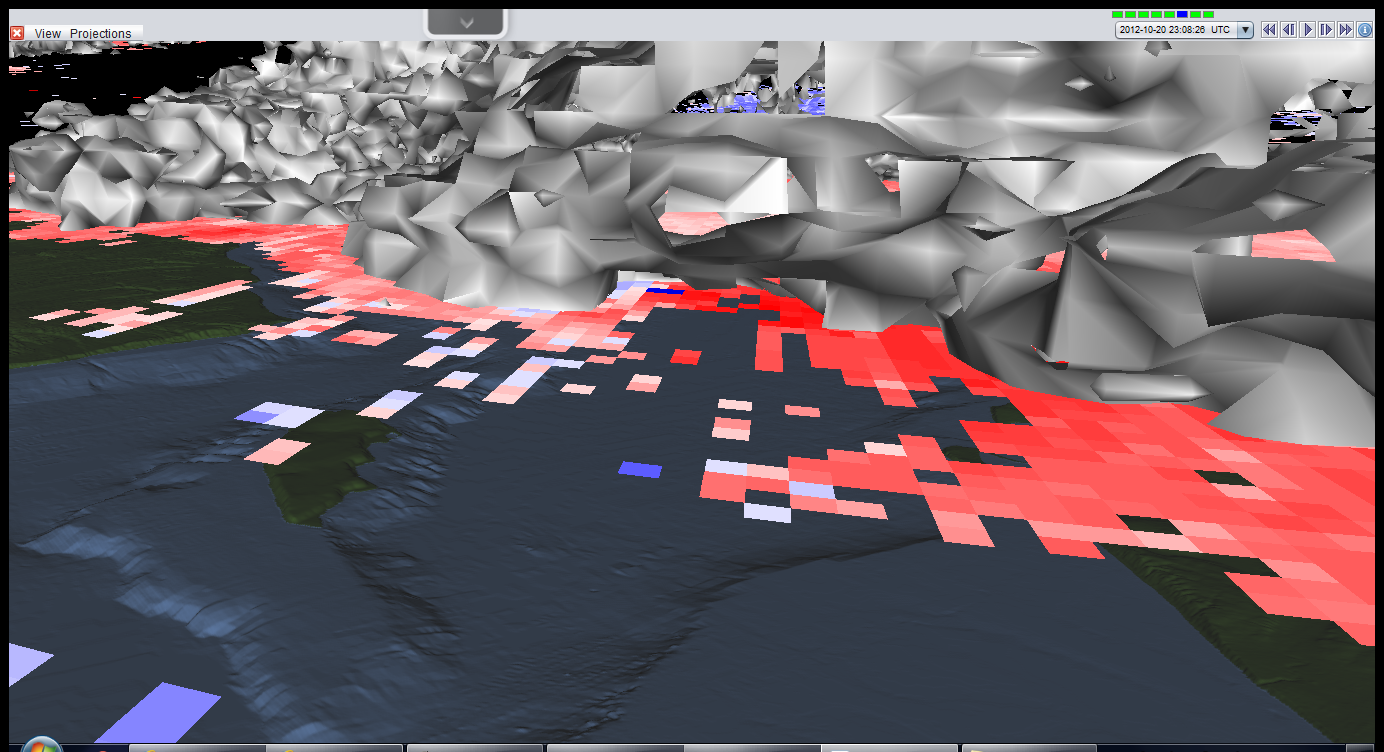
Next is the radial velocity data from
the same radar scan with the same field of view. Near the center of the image
are some very boldly colored pixels, but some are red and some are blue. This
is likely a sign of concentrated rotation.
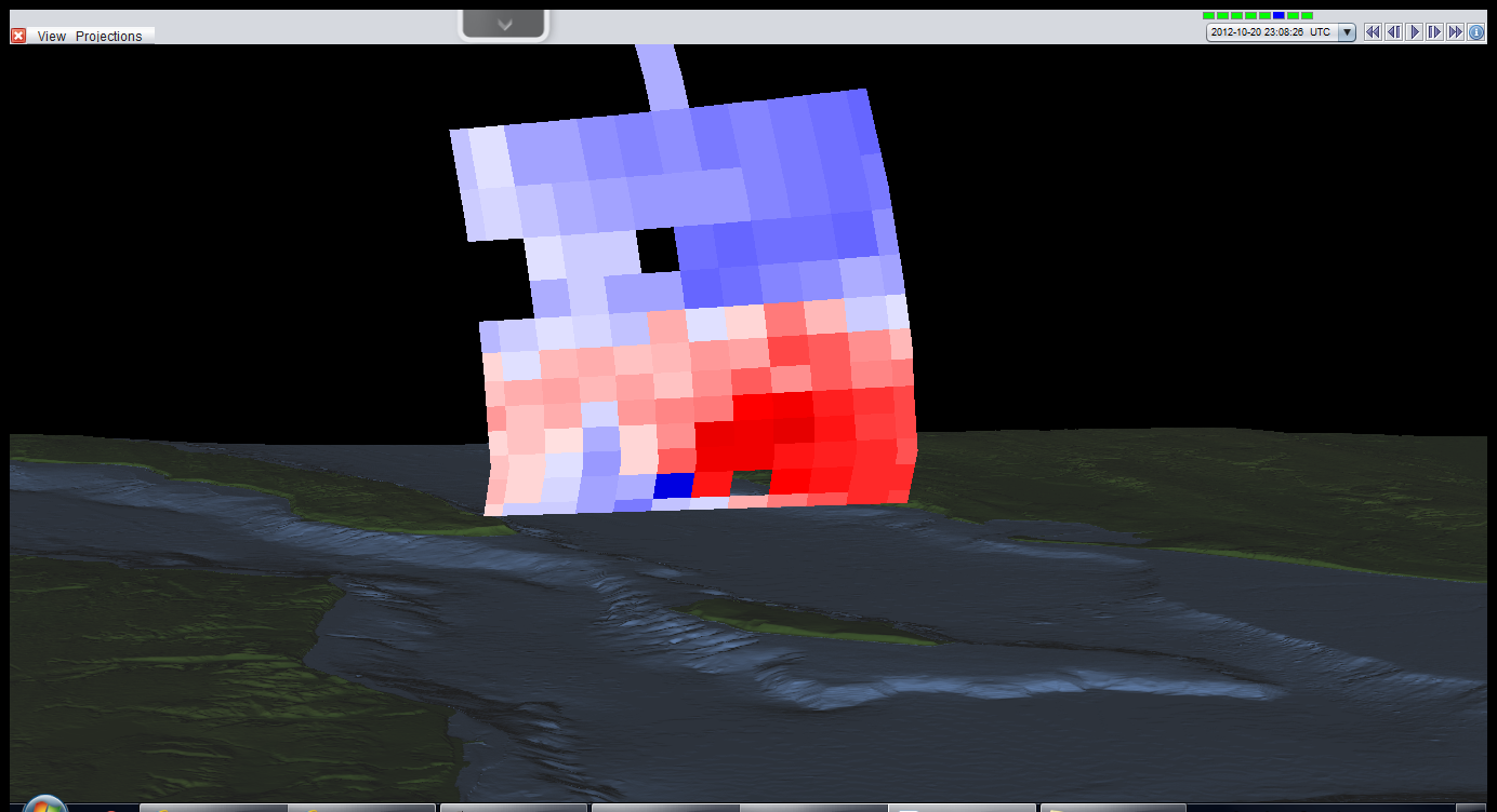
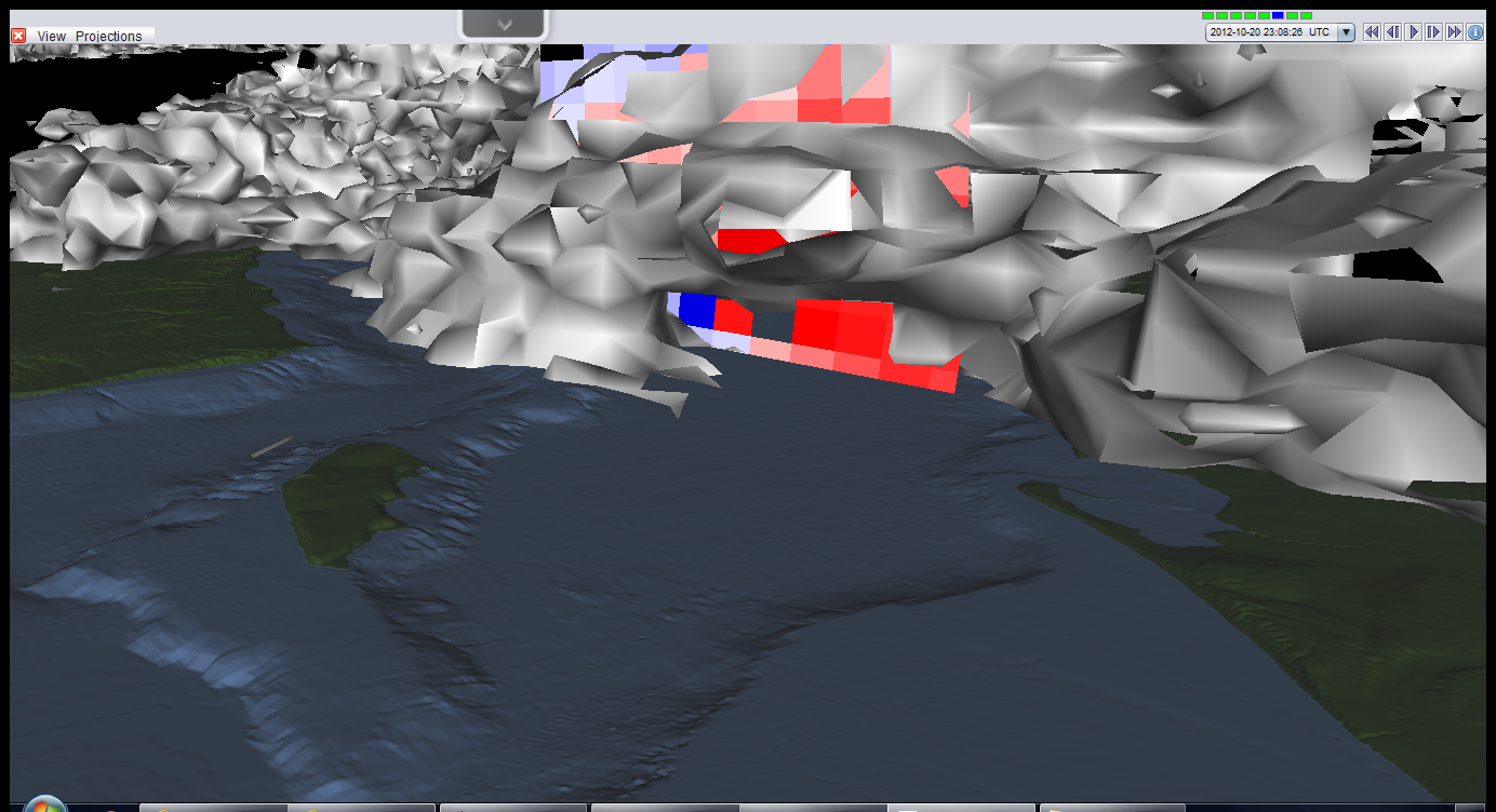
Using the same data as the last
image, I constructed a cross-section right though those bold pixels. Even in
the vertical, there is some bold blue right next to bold red. I might really be
on to something...
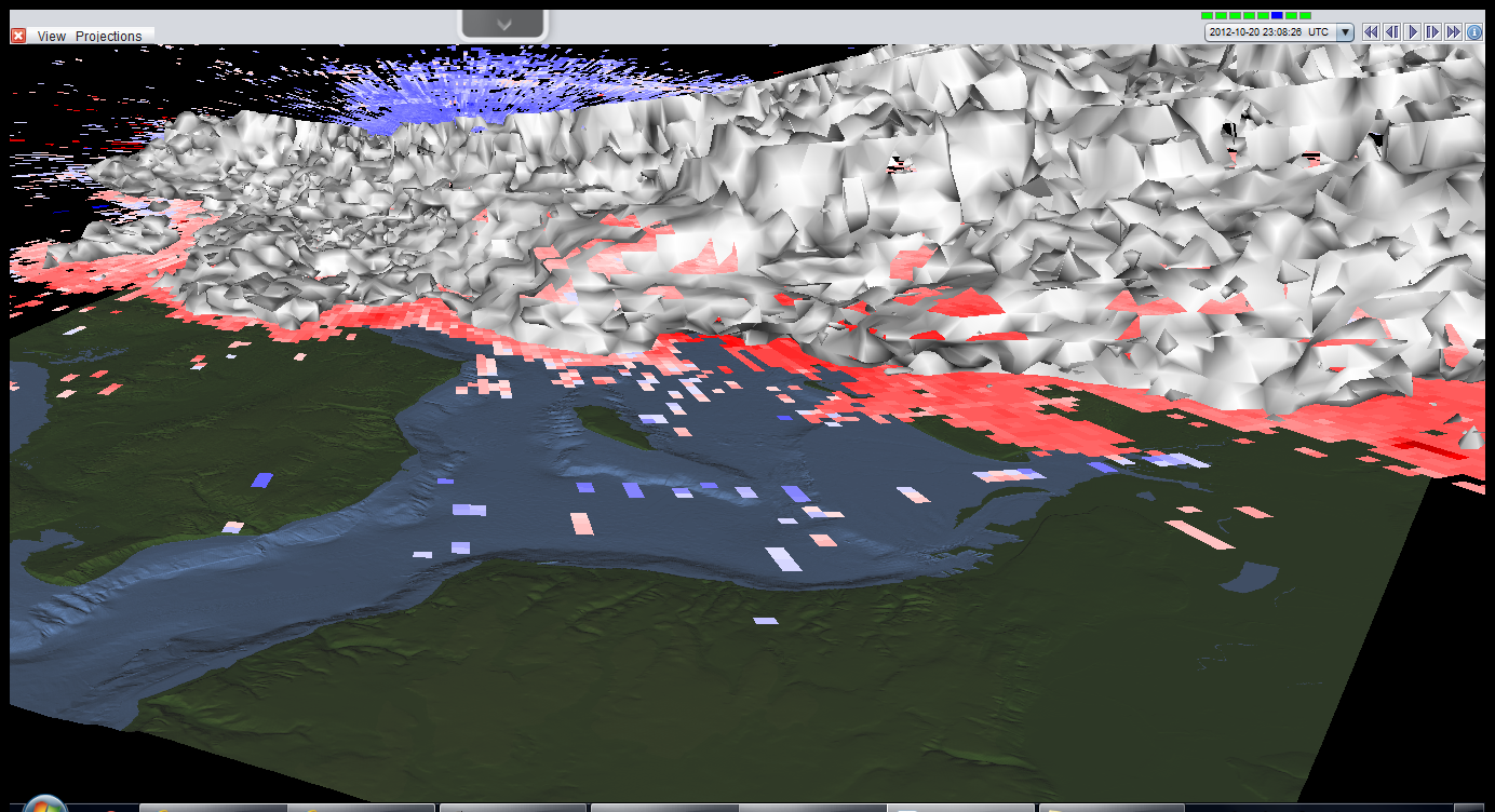
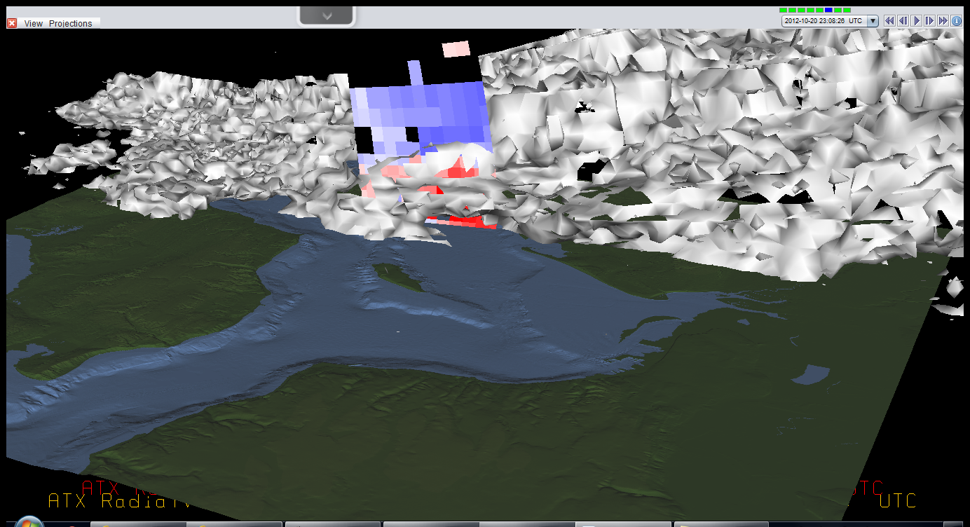
So now I get a little tricky. The
tangled white mess is called an isosurface. This means that everywhere on the
surface some parameter has the same value. In this case, everywhere on the
white surface, the radar measured the same reflectivity value. This somewhat
shows the distribution of clouds.
Now I've turned that velocity data
back on. If you look closely, there is a little hollow area near the center. In
that area are those bold pixels.
Now the cross-section has been turned
back on. Once again, those bold pixels are located in that little cavity.
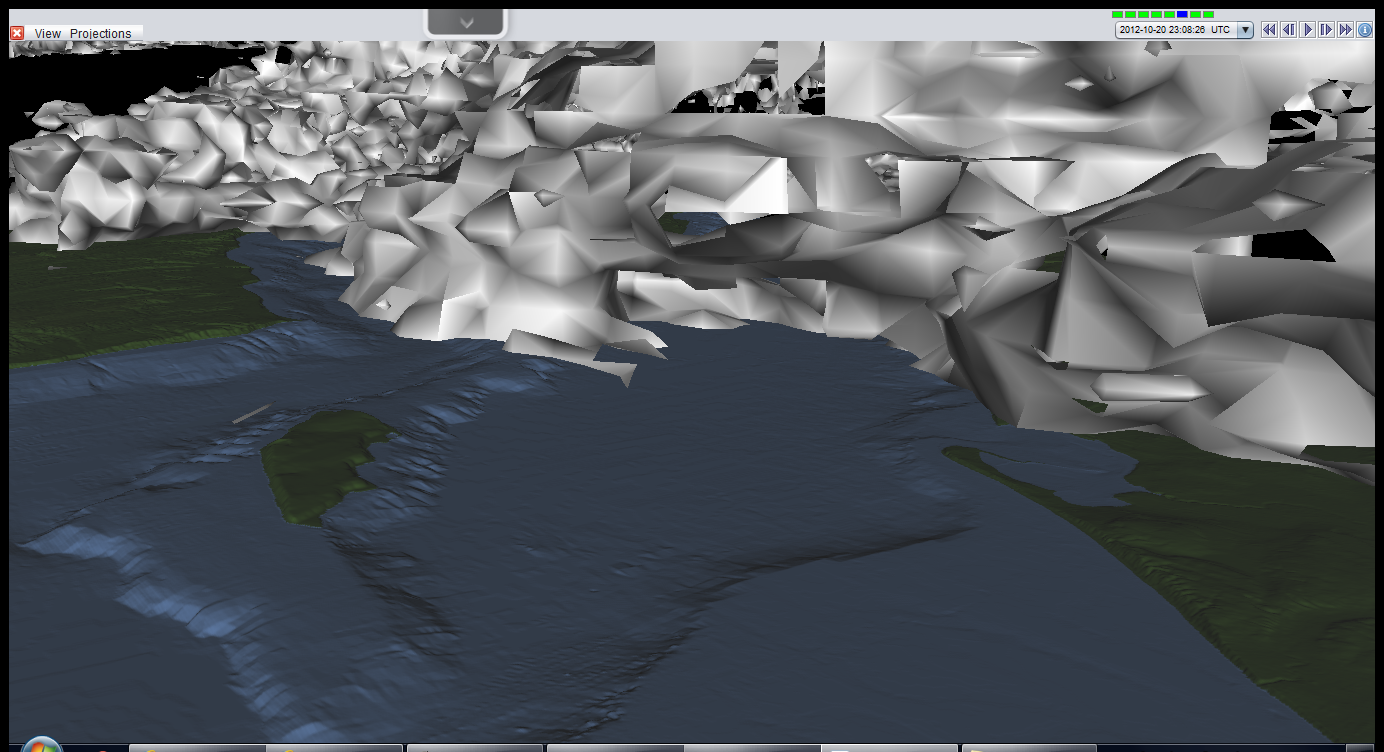
This is the same series of data as
the previous three images, just zoomed in more.
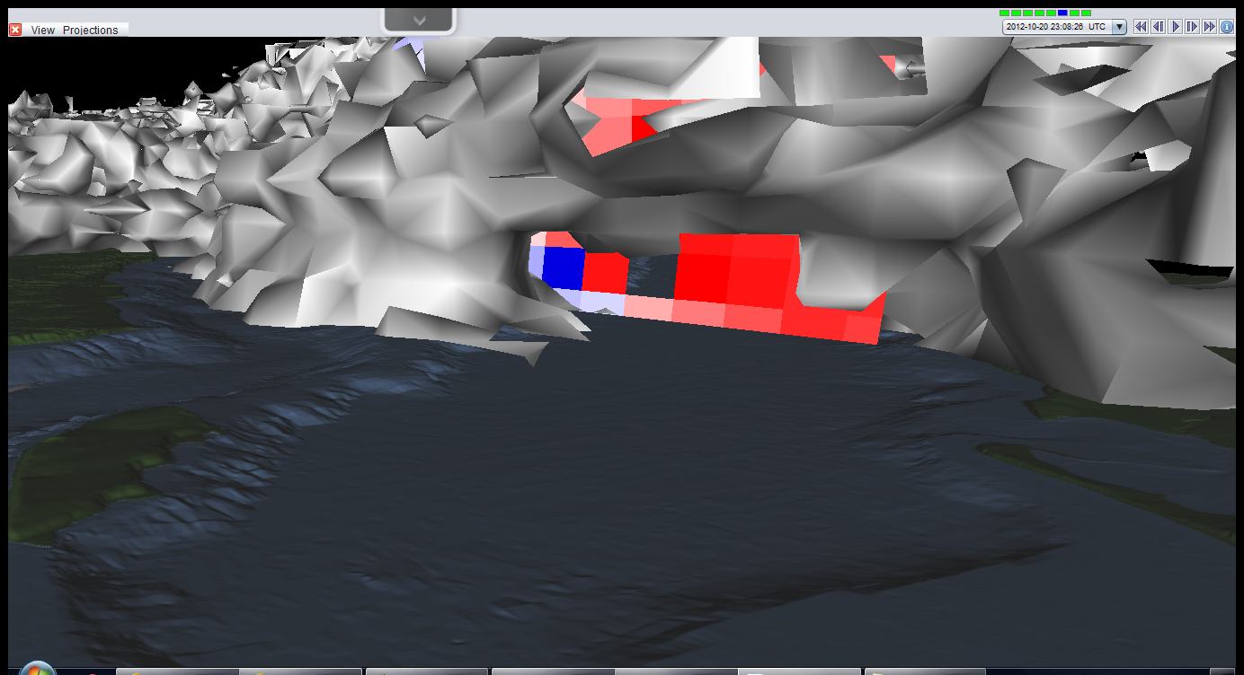
Now it’s really zoomed in. It is very
clear something is going on in here. And look at little speck at the
bottom of the data, just below the bold red pixel, interesting.
Ta da! With the cross-section off, it
is clear that the little speck is really some pointed feature right in the
middle of the cavity. That, I believe, is the radar signature of the waterspout
itself. All of this even agrees with the actual photos. Remember the heavy rain
from the first one? That would be the wall of white in the back of the cavity.
Furthermore, it was nearly sunny in the second picture, which matches the radar
image, where no rain is detected south of the cavity.
Wow, I never expected to find data this
good. I'm glad I checked.
No comments:
Post a Comment