This page contains many tools to aid in analyzing tropical cyclones and anticipating their formation. Each image on this page is designed to update automatically, thus this data can be considered near real time (NRT). These images are pulled from multiple websites:
Satellite imagery makes up the bulk of the data here, beginning at the global scale then organized by basin. Among the products provided in each basin are IR satellite images that have wind barbs superimposed on them. These were calculated using the movement of clouds and apply to a layer between 950mb and 400mb (about 550m to 7200m), which is basically the lower half of the troposphere in the tropics. Also present are IR/WV images of vertical wind shear and its direction. Tropical cyclones require low shear (30kt at most) to form and develop. Finally, some satellite products are not available for the far eastern north Atlantic and the western Indian Ocean. The sectors are monitored by European satellites and they feel weather information should have a price tag.
-------
 |
| Location of current tropical systems. "I" means invest area, "L" means tropical depression or remnant low, a symbol with an open center means tropical storm, and a symbol with a filled center means hurricane, typhoon, or cyclone. Click on the image to open the CIMSS TC page for more detailed information. (CIMSS) |
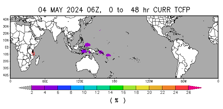 |
| Colored shading highlights the probability of a tropical cyclone forming in the next 48 hours based on computer models. Click on the image to open the NESDIS page which covers this product in more detail. (NESDIS) |
 |
| The end of the colored line shows the strength and location of the active phase of the Madden-Julian Oscillation (MJO), which signifies large area of disturbed weather, centered on the equator. The further the line end is from the center, the stronger the MJO. Note that the "Maritime Continent" is the general name for the region around Indonesia and the other Southeast Asian islands. Click the image to open the BoM page with further details. (BoM) |
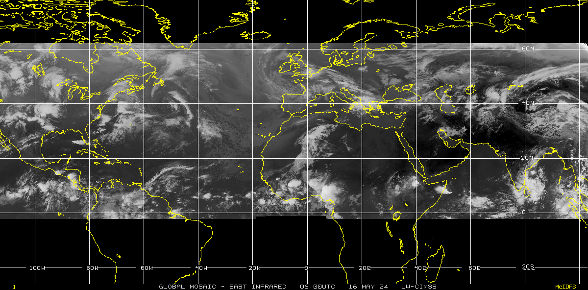 |
| Current composite of IR imagery centered on the Atlantic (CIMSS) |
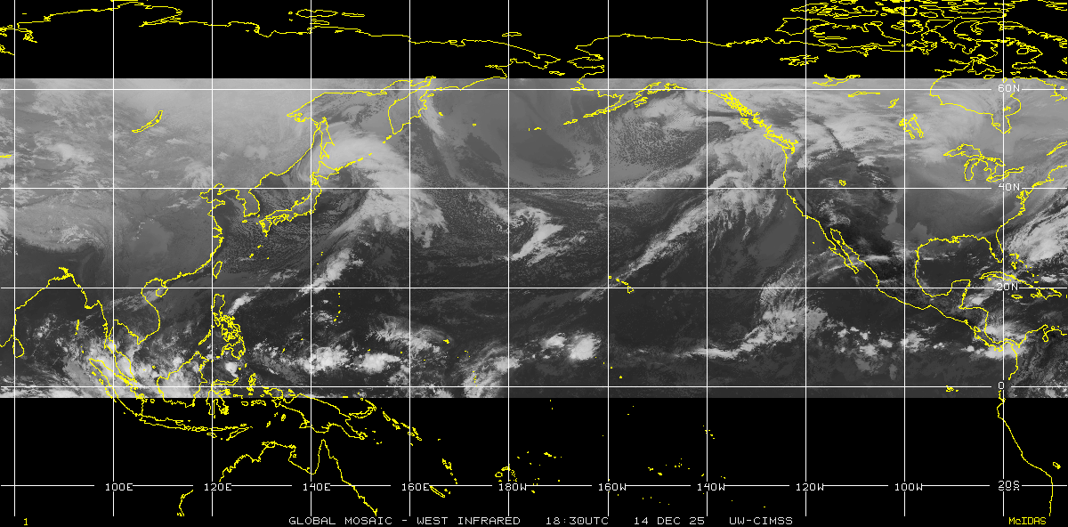 |
| Current composite of IR imagery centered on the North Pacific (CIMSS) |
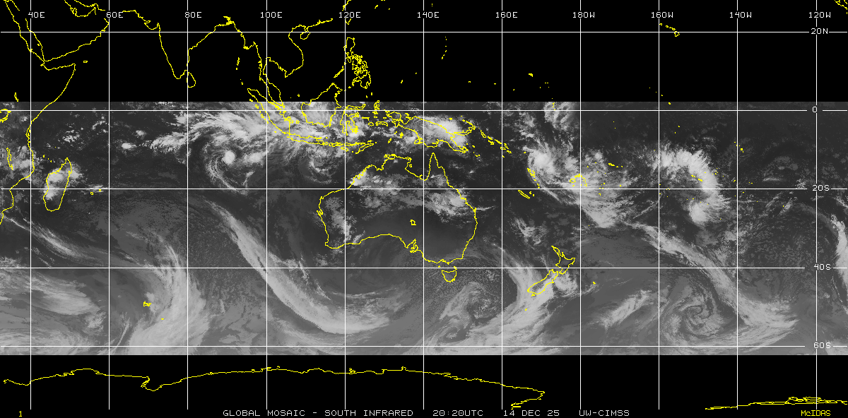 |
| Current composite of IR imagery centered on Australia (CIMSS) |
-------
NORTH ATLANTIC
 |
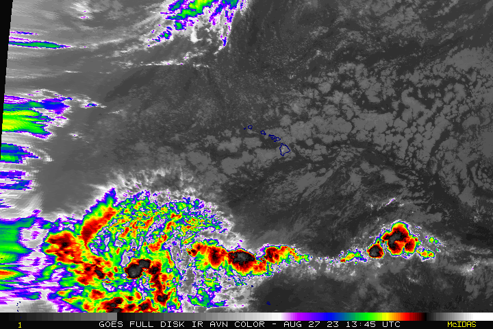
| Atlantic Ocean and far eastern Pacific colorized IR loop (NESDIS) |
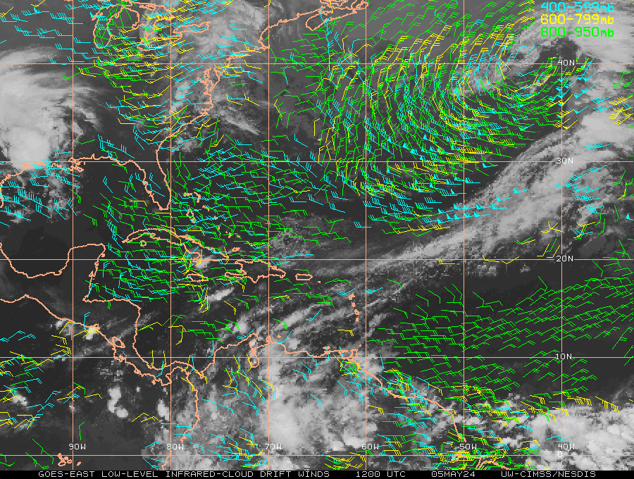 |
| Atlantic Ocean and far eastern Pacific winds (CIMSS) |
 |
| Atlantic Ocean and far eastern Pacific wind shear (NESDIS) |
-------
NORTHEAST PACIFIC
 |
| Northeast Pacific Ocean and far western Atlantic colorized IR loop (NESDIS) |
 |
| North Central Pacific Ocean colorized IR loop (NESDIS) |
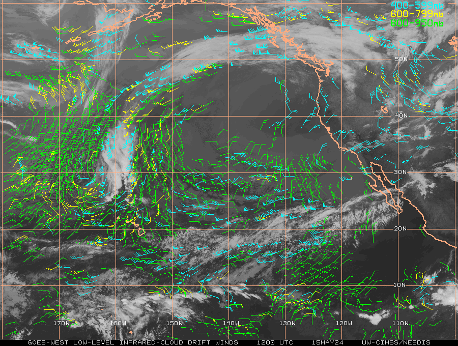 |
| Northeast Pacific Ocean and far western Atlantic winds (CIMSS) |
 |
| Northeast Pacific Ocean and far western Atlantic wind shear (CIMSS) |
-------
NORTHWEST PACIFIC
 |
| Northwest Pacific Ocean colorized IR loop (NESDIS) |
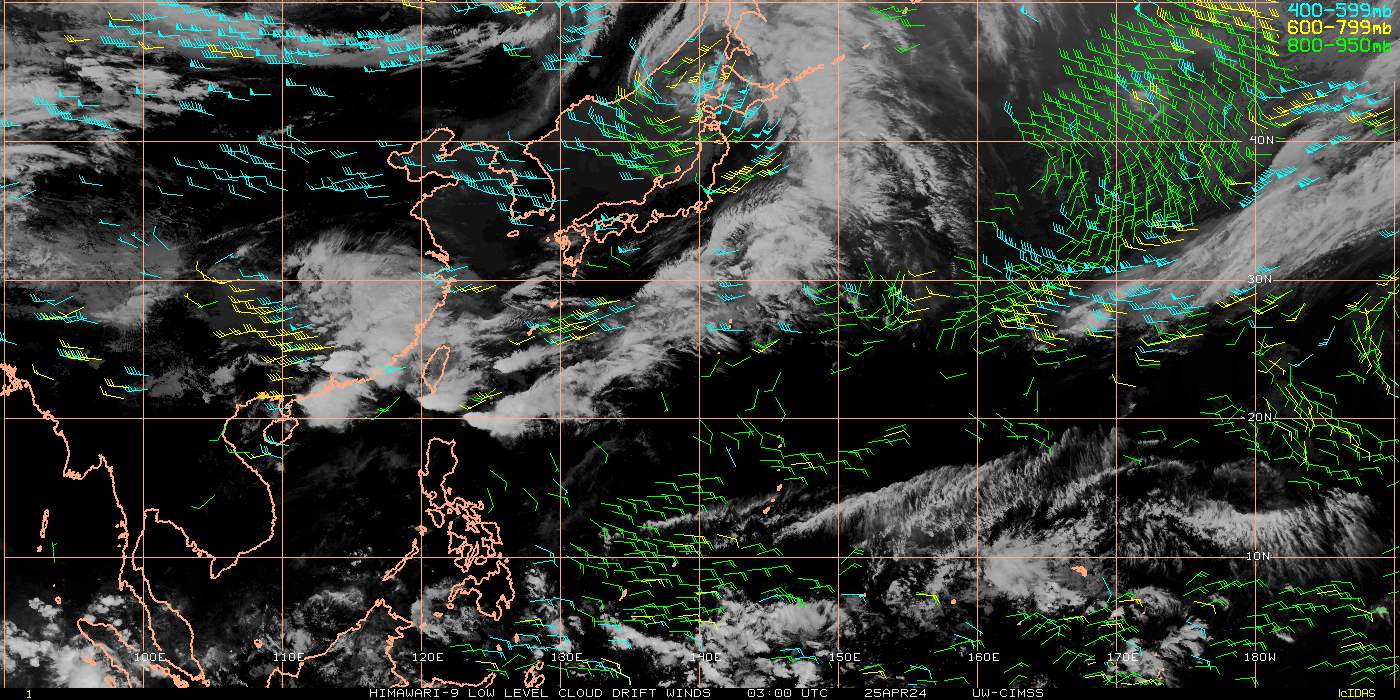 |
| Northwest Pacific Ocean winds (CIMSS) |
 |
| Northwest Pacific Ocean wind shear (CIMSS) |
-------
INDIAN OCEAN
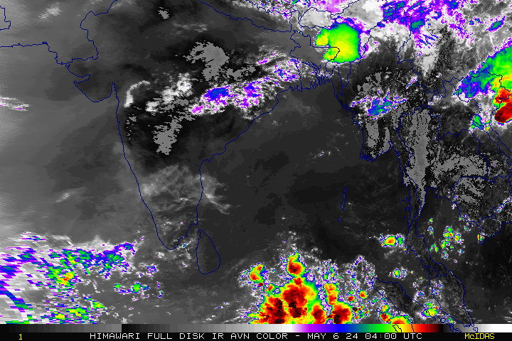 |
| Central and Northeast Indian Ocean colorized IR loop (NESDIS) |
 |
| Southeast Indian Ocean colorized IR loop (NESDIS) |
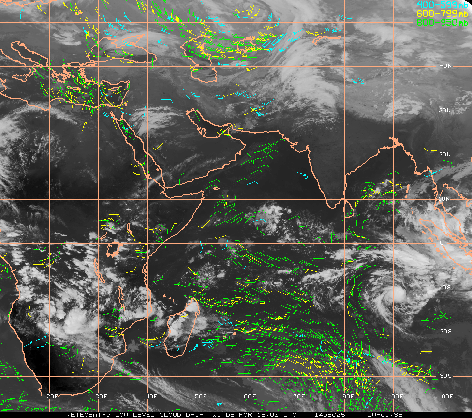 |
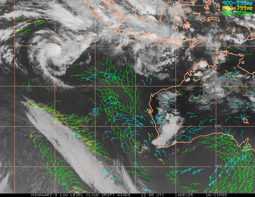
| Indian Ocean winds (CIMSS) |
 |
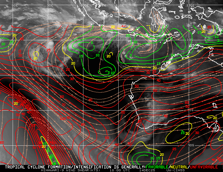
| Indian Ocean wind shear (CIMSS) |
-------
SOUTH PACIFIC
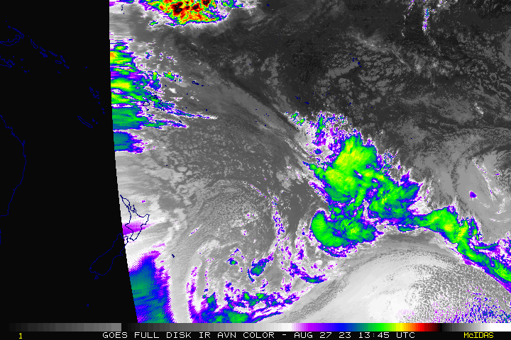 |
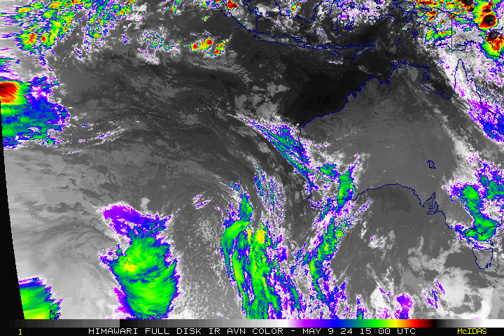
| South Pacific Ocean colorized IR loop (NESDIS) |
 |
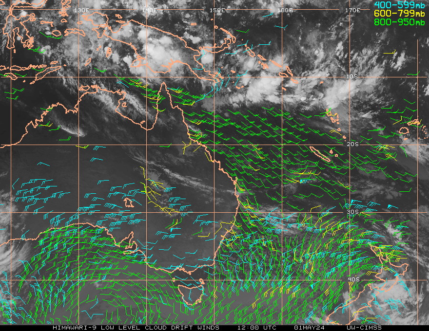
| West Australian region winds (CIMSS) |
 |
| West Australian region wind shear (CIMSS) |
 |
| East Australian region winds (CIMSS) |
 |
| East Australian region wind shear (CIMSS) |
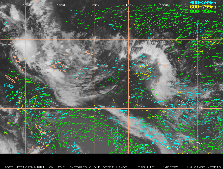 |
| South Pacific Ocean winds (CIMSS) |
 |
| South Pacific Ocean wind shear (CIMSS) |
No comments:
Post a Comment