2015/12/23

101: Weather Radar (Reflectivity)

Radar Reflectivity


Intensity Defined

Reflectivity is the oldest and most widely used product of weather radars. Until the arrival of the WSR-88D in the 1990s, reflectivity was the only base product available for operational use. As mentioned in the previous post, radar power is measured in decibels, a logarithmic unit, because there is such gigantic difference between the power that is emitted by the radar and the power that is returned to the radar. However, one must also consider the fact that since the radar beam spreads out, targets closer to the unit will have stronger returns than those further away, even if the targets' actual intensities are the same. For this reason, a value known as equivalent reflectivity is used to account for difference in power. The equation is actually quite simple:

Equivalent Reflectivity = (power returned to radar * the square of target's range) / (the product of two constants)

Even in this scale, the resulting value can range anywhere from ten to tens of millions, thus another logarithm (base 10) is applied, resulting in units of decibels of equivalent reflectivity (dBZ):

dBZ = 10 * log (equivalent reflectivity)

Thus an equivalent reflectivity value of 10 would yield a dBZ of 10 and a value of a million would yield a dBZ of 60. Negative dBZ values are the result of equivalent reflectivity between 0 and 1. These dBZ values are what is typically used to express reflectivity, thus they are often referred to simply as intensity. Most color tables (figure 1) used in radar images have dBZ values ranging from -10 or 0 to 80 dBZ.

Figure 1: Some of the commonly used color tables used to depict reflectivity intensity.


Level II Base Reflectivity

With the full volume scan that encompasses all tilts, level II reflectivity files allow for the creation of images in three dimensions. The first of these is the radar cross section. These are much like the RHI (range-height indicator) displays of previous radar generations, except the slice can be made through any part of the radar volume, instead of being limited to just along the radials. Cross sections are a great way to identify specific storm structures that might be a sign of severe weather (figure 3). Radar volumes, also known as lit volumes, are 3-D displays of the entire radar scan, regardless of the intensity, depicted as dots (figure 4). By choosing the right color tables and transparency settings, these images allow some of the key structural features of storms to be viewed together. The downside to these displays is that they are often hard to interpret and visualize due to the large amount of data being displayed. Finally, the radar isosurface display limits the amount of data depicted to only the extent of a user defined intensity (figures 5 and 6). Isosurfaces are displayed as smooth surfaces of interpolated data instead of dots, making them clearer, thus they are generally preferred over radar volumes. It is important to remember with all operational radar displays that the radar is not showing the storm cloud itself, but simply the regions in which targets exist to scatter the radar beam (figure 7).

Figure 2: The full resolution level II reflectivity image from the Lubbock, TX radar (KLBB) of the April 11, 2015 (April 12, 2015 0047 UTC) scan used in the following few graphics.

Figure 3: Looking to the southeast, this cross section is oriented east-west and slices through the most intense part of the storm.

Figure 4: The radar volume from same time as above. The dots allow the core of the storm to be seen, although it can be hard to get a clear picture of the storm's structure.

Figure 5: This isosurface is at the same time and marks the extent of the 18.5 dBZ intensity. Notice that it is still a little noisy.

Figure 6: This is also a 18.5 dBZ isosurface, but made using a different program that constructs the surface differently. The flat, sloped top near Lubbock is likely not the top of the storm, but the highest the radar beam was able to reach since the storm was quite close to the radar at the time, so some the the storm was in the cone of silence.

Figure 7: A radar cross section is overlaid onto a screen shot from the Lubbock National Weather Service office's webcam at the same time as the scan. Notice the echo only shows the precipitation core, not the entire cloud's extent. The upper portions of the cross section were made using data from the more distant Amarillo radar (KAMA), which could see into Lubbock's cone of silence.


Level III Products (and their product codes)

Level III Base Reflectivity (N0R, N1R, N2R, N3R, NAR, NBR, and many others)
Many of the derived values produced by the radar's programming uses just the base reflectivity data. The most basic of which are the quality controlled versions of the reflectivity data. Depending on the radar's current VCP, these products can include data from the 0.5 degree tilt up to the 3.5 degree tilt (figure 8). While useful for their small size and quality control, these products are at a lower resolution than their level II counterparts.

Figure 8: The level III base reflectivity of the 0.5, 1.5, 2.5, and 3.5 degree tilts (N0R, N1R, N2R, and N3R, respectively).


Composite Reflectivity (NCO, NCR, NCZ)
After completing the full volume scan, the radar selects the highest value measured for each gate, regardless of tilt, and maps those onto one file (figure 9). This data is useful in locating areas of the strongest intensity, but since it only displays the strongest signal, composite reflectivity typically masks storm structure. Typically it is wise to only use this to identify regions of strong convection when investigating a large region.

Figure 9: The composite reflectivity product (left) compared to the 0.5 degree base reflectivity product. Notice the small red marker on the south side of the storm. On the base reflectivity image it is on the edge of the storm near a large gradient of intensity, while it is well within the composite reflectivity's depiction of the storm. This means there is a part of the upper portion of the storm that must be overhanging the lower levels. A feature such as this is very important and may indicate that the storm is, or will soon be, producing severe weather.


Precipitation (before dual-pol: N1P, N3P, NTP, with dual-pol: OHA, PTA)
These products attempt to estimate the total precipitation that has fallen over the course of the previous hour (N1P/OHA), the previous three hours (N3P), or since the storm began (NTP/PTA). Originally, empirically derived formulas were the basis for converting radar intensity to precipitation amounts. Now that radars have dual-pol capabilities, the radar decides what conversion algorithm to apply to each gate based on what kind of precipitation it estimates to be occurring there. Many assumptions are made that must be taken into account when using these products (figure 10). The most important assumption is that all precipitation the radar detects will reach the ground. In cases of high cloud bases or when a layer of dry air exists below the radar's beam, these products will produce an overestimate because much of the precipitation will evaporate before reaching the surface.

Figure 10: The storm total precipitation from the Seattle, WA radar (KATX) of a widespread heavy rain event displays some of the issues with the precipitation estimate. Notice that the highest values roughly form a ring around the radar. In reality, the rainfall was more or less evenly distributed across most of the region, but at close range the cone of silence prevented much of the precipitation from being counted and at long range the radar beam entirely missed the lower portions of the precipitation.


Vertically Integrated Liquid a.k.a. VIL (NVL, DVL)
This product is used in much the same way as composite reflectivity. Instead of mapping the greatest dBZ value in a column above a point, the VIL product uses an algorithm to estimate the amount of liquid water contained in a column above a point (figure 11). This is useful in locating areas of heavy precipitation and hail.

Figure 11: The VIL product from the same Lubbock storm used earlier shows how the storm's core is highlighted, making it easy to identify the storm as very intense.


Echo Tops (NET, EET)
These images plot the height of the highest return of 18.5 dBZ in a column (figure 12). This is useful for getting a basic grasp of storm structure and is widely used by pilots during briefing. Since the radar beam has limited visibility in the vertical, it may be possible that the height of a 18.5 dBZ intensity may be above the radar's highest tilt, thus the reported echo top would simply be the highest the beam can sample, thus giving limited information about the storm structure. This is particularly a problem close to the radar unit itself where storms can easily extend into the cone of silence.

Figure 12: The echo top product reveals the updraft core of the storm, but the slight curve to the greatest height values (the KLBB radar makes the center of the curve) probably means that the true top of the storm was in the radar's cone of silence.


Storm Structure (NSS) and Storm Track (NST)
By using predefined thresholds, the radar unit attempts to locate the core (called the centroid) of a storm cell. Tracking the location of these cores allows the Storm Cell Identification and Tracking algorithm to estimate properties of storm (figure 13) such as its speed, direction of movement, echo top, VIL, storm base, and maximum reflectivity (as well as the height this occurs at). Some radar visualization programs allow the storm data to be displayed as an overlay on the main image along with lines depicting the forecasted track of the storm over the next hour. If there is uncertainty in the storm motion, the displayed track will be shortened to 45, 30, or 15 minutes. Thus, the length of the track indicates the confidence in the track. It is important to note that the storm motion does not involve any of the other base products, including velocity data.

Figure 13: The storm cell's attributes and forecasted track are overlaid on top of its base reflectivity image.
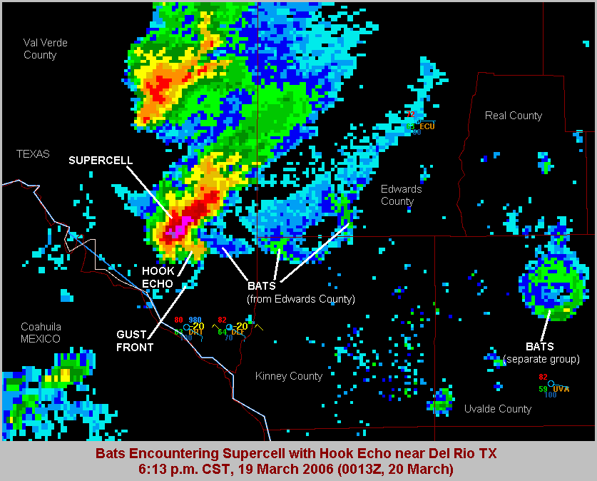

Hail Index (NHI)
The Hail Detection Algorithm uses a set of criteria to estimate the location of hail. The output is usually displayed either along with the storm structure and track and/or its own overlay icon (figure 14). A key component to the algorithm is the height of the 0 and -20 degree Celsius levels, which are supplied by the radar operator or from the latest forecast model. The output data includes the probability of hail (POH), the probability of significant hail (POSH; 1 in or larger), and the maximum estimated size of the hail stones. Due to the widening of the radar beam at long distances and the issues involving the cone of silence at close ranges, the hail product is considered to be most reliable between 30 and 60 nautical miles (nm) from the radar site.

Figure 14: The green triangle is coincident with the centroid of the cell and indicates the hail size. Further information on the hail can be found in the radar's storm attributes table (the displayed cell is named L0 in the table).

2015/12/11

101: Weather Radar (The Basics)

In the last post on weather radar, I covered their history and a few basics of their operation. In this post I'll dive into how the radars work and some of the important limitations of these tools. Please note that for the rest of the radar posts I will be referring to US weather radar since, at the time of this writing, the US is the only country whose entire base radar data is freely available to the public. I sincerely hope this changes in the future.


The Science of Weather Radar

The Beam
A radar beam is nothing more that a pulse of light. Since light can be thought of as a basic sine wave, it can be described by its wavelength or frequency; for the purposes of weather radar, typically wavelength is used. All types of radar use light in the microwave portion of the spectrum (figure 1), which has far longer wavelength than the visible light we can see. Visible light ranges roughly between 0.00004 and 0.00007 cm, while radar uses microwave light with wavelengths between about 1 and 10 cm. Because of the many uses of microwaves, engineers often describe particular microwave wavelengths as named bands. The US' WSR-88D, and the retired WSR-57,  uses the S-band (the S stands for short), which has a wavelength of about 10 cm. The TDWR and WSR-74C on the other hand use the C-band (C is for compromise between the longer S and shorter X bands) with a wavelength of 5 cm. Finally, the original WWII radars, as well as current airborne units, use the X-band (X comes from it beginning as a 'secret' band in WWII), which has a wavelength of 3 cm. The important thing to remember is that shorter wavelengths provide higher resolution, but the beam is more easily degraded, thus they have shorter ranges.

Figure 1: These are the various bands along the microwave spectrum, along with visible light for reference. The bands used by weather radar (S, C, and X) are near the center of the graph.

The basics of how a radar works is actually quite simple. When the radar beam encounters a particle, the light ends up being scattered in all directions, the portion of the scattered light that returns to the radar is called backscatter; this is what provides the radar with information. This type of scattering behavior is called Rayleigh scattering and applies to all particles with a diameter less than about one-fifth the wavelength of the beam, thus for S-band radar the cutoff is 2 cm and for C-band it is 1 cm. Therefore, large particles, particularly hail, scatter light in a much more complicated manner called Mie scattering (which will not be covered here due to its complexity). The amount of energy that returns to the radar is incredibly small relative to the amount emitted by the radar unit. The WSR-88D transmits at about 106 watts while the amount that returns to the unit may be on the order of 10-12 watts. Thus radar power is typically expressed as decibels, which is a logarithmic scale.


The Radar Volume
One advantage the NEXRAD system has over previous networks is the ability to produce volume scans. One volume scan contains all the data gathered from all tilts of a full 360 degree sweep (figure 2). The tilts available to the WSR-88D range from 0.5 degrees (a few units also include a 0.1 degree tilt) to 19.5 degrees. Anything that exists above the 19.5 degree angle will not be seen by the radar, thus this region above the radar volume is known as the "cone of silence". When displayed, the radar volume can be broken up into individual pixels, known as gates. Each gate's dimensions are measured by the width of the radar beam (in both the horizontal and vertical), known as the radial resolution, and the width along the beam's radial, known as the gate resolution. It is imperative to remember that even though the radar might be set to a specific tilt, the beam itself has width, which increases with distance from the radar. Thus while the radial width of each gate remains constant, the horizontal and vertical dimensions become larger with distance (a rule of thumb is that a 1 degree wide beam will have a diameter of 1 mile for every 60 nautical miles from the radar unit). Originally, the WSR-88D's gates were 1 degree by 1 km. However, in 2008, using some fancy computer coding work, the entire NEXRAD network was upgraded to "super resolution", which increased the radial resolution to 0.5 degrees and the gate resolution to 0.25 km.

Figure 2: This is a cross-section straight through the radar volume showing all 14 tilts in super resolution. The radar unit itself is located to the left of the center where the various radials converge, while a developing thunderstorm is near the center.

Contained in each volume scan package are three levels of data (figure 3). Level I data is relatively meaningless to humans and is only available at the radar unit itself to engineers. Level II data is the raw data types at their maximum resolution: reflectivity, radial velocity, and spectrum width. Since the upgrade to dual-pol, differential reflectivity, correlation coefficient, and specific differential phase have been added to the level II data stream. Finally, there are the level III products, which consist of derived values computed by the radar. Each level III file is two dimensional, consisting of just one tilt (where applicable), one product, and are identified by a three letter code. The lower tilts of the level II products are made available as level III flat files that have typically undergone some quality improvements. Common examples of the computed data are composite reflectivity, storm-relative radial velocity, precipitation totals, and now the hydrometeor classification algorithm (which makes use of the dual-pol data). Since level III products are flat files, they are far less computationally intensive, although often at the cost of some resolution. There are over 150 different level III products available, so it helps to know what you are looking for, thankfully, some radar display programs combine most of these products into single files, allowing different types of data to be viewed simultaneously. It should be noted that TDWR data is currently only available as level III data.

Figure 3: Level 1 (left), level II (center), and level III data from the same scan.


Radar Limitations
Just like any technology, radar is prone to its' own set of issues the user must be aware of. As with the "cone of silence" issue discussed above, there are several issues that arise from the geometry of the radar beam itself. First of all, one must remember that all tilts are exactly that: tilts. This means that even at the lowest tilt, targets  further away will be detected higher than those closer to the radar (figure 4). To complicate things further, the radar beam does not radiate out in a straight line, but curves slightly downward. This is a result of the general decrease in the density of the air with altitude. Since light travels faster through a vacuum, the top edge of the radar beam travels faster than the bottom edge, resulting in refraction. Despite this, due to the Earth's curvature, the net result is that the beam typically appears to curve slightly upward when plotted on a flat map (note the curve in figure 2). In cases where there is exceptional warming with height (an inversion) or strong moisture decrease with height, the beam can be refracted so strongly that it curves all the way down to the ground in what is known as superrefraction (figure 5). Occasionally, the beam will beam will be superrefracted just enough that it travels roughly parallel to the earth's surface, a condition known as ducting.

Figure 4: Two different radar sites will sample the same target at different altitudes due to the tilted nature of the beam.

Figure 5: In this example, the radar beam was superrefracted and bent all the way down to the ground. The line of weak echoes inside the circle are actually cars on a highway. 

Another important factor to consider is range folding. To understand this, imagine a thunderstorm 100 miles away, thunderstorm A, and one 200 miles away, thunderstorm B. When the radar emits a beam pulse, both storms will eventually cause some of the signal to be reflected back to the radar unit. The radar then calculates the distance of the storms based on how long it took for the signal to be returned. Thus, storm A's signal will arrive back at the radar unit in half the time as storm B's. For simplicity, let's say that the time the beam takes to leave the unit, encounter storm A, and return to the unit is 2 seconds (4 seconds for storm B). If the radar emits a pulse every 3 seconds, a problem occurs: the radar will assume all backscattered light came from the same pulse, which would work just fine for storm A. However, by the time the next pulse is emitted, storm B's signal will not have reached the unit yet. Its' signal will reach the radar unit 1 second after the second pulse, therefore the radar will assume storm B is just 50 miles from the radar. The radar has no way of knowing that storm B's signal came from the first pulse. This issue is known as range folding. Modern radars have methods of "unfolding" the beam, but errors can still happen; these typically appear as elongated streaks of echoes. Thus, it is important to have a general understanding of what the radar should be seeing in order to notice these erroneous signals, known as second-trip echoes (figure 6).

Figure 6: In this case several second-trip echoes contaminated the image, the most pronounced are the blurry streaks just to the right of due north from the radar (center).

Figure 7: At sunrise and sunset, the Sun's rays will be aimed directly at the radar, causing a thin line of echoes to appear to radiate out from the radar unit. These are called Sun strobes and will only last one or two scans. Since they can be so precisely predicted, they were used to calibrate some of the early radars.

Figure 8: Tall structures such as windmills often backscatter the radar beam strongly. For this reason, a database of all wind farms (and other large obstacles) is maintained to prevent erroneous identification of radar targets.

Figure 9: Biological targets, such as birds, insects and bats, also show up on radar. This has long been an issue in southwest Texas where large populations of bats emerge each night.


2015/12/04

101: Weather Radar (Radar History)

It began with WWII. As the world plunged into its' second great war, the significance of radar technology became immediately apparent. Soon, the armed forces of the United States, Russia, and Germany had all developed and fielded their first generation of aircraft surveillance radar. However, there was a problem: weather often cluttered the signal and inhibited the ability to reliably track enemy activity. There were some though, who saw this annoyance and realized a way to turn these lemons into lemonade. Thus, by the end of the war, dedicated weather radar had become an important tool in the meteorologist's arsenal.


The History of Weather Radar


First Generation:

Radar, which is actually an acronym for RAdio Detection And Ranging, began its meteorological career as a secretive and highly expensive technology. Although purpose build units were constructed in the United States (figure 1), mainly for research, the first true application of radar as an operational tool occurred in the Pacific towards the end of the World War II. Perhaps the most notable of these early applications was the tracking of Typhoon Cobra by US Task Force 38 while en route to the Philippines (figure 2). For the first time, the intricate structure of an intense tropical cyclone was able to be observed. Unfortunately, those ships that observed the storm were also struck by it, resulting in 790 fatalities, several sunken ships, and hundreds of planes lost. It was events like this, and another typhoon incident less than a year later (involving the same fleet), that caused radar to be seen as an integral part of operational meteorology, instead of just some technological curiosity.

Figure 1: An early radar image depicting a cold front approaching Boston.

Figure 2: Typhoon Cobra as seen on radar from aboard one of the Task Force 38 ships on 18 December, 1944. 

As soon as the war ended and radar technology became declassified, the Weather Bureau acquired 25 ex-navy units for use in weather research. The first radar designed specifically for weather surveillance was the CPS-9, which was installed in military bases around the US in the mid-1950s. This first generation of weather radar was significantly hindered by the Weather Bureau's policy of providing only daily forecasts, thus radar's primary function, as a early warning aid, was seriously neglected. This shortcoming was not lost on the public, especially since the US military's weather service had been issuing successful storm warnings for years. With mounting pressure from the public and congress, the Bureau changed their position and began issuing warnings in 1952. However, for them to be effective, they would need a new radar network.


Second Generation:

Beginning in 1961, a new radar network was deployed across the US east of the Rockies consisting of the newly developed WSR-57 (Weather Surveillance Radar - 1957) units (figure 3). Unlike the digital, automated operation of today's radars, the WSR-57s required an operator to be physically stationed at the site (figures 4 and 5). The operator would manually adjust the unit's direction and tilt to interrogate storms and other weather phenomena. Then, they would note the general location of weather echoes and send this information off to Washington, D.C. where a national mosaic of radar descriptions would be produced once an hour. Eventually this process became more and more automated to the point that raw data could be sent directly to forecasters by the late 1970s. While useful in identifying storms, the early radar units could only detect reflectivity and discriminate between just a few different values of intensity.

Figure 3: An old retired WSR-57

Figure 4: The WSR-57 workstation at which a radar operator would make observations. The cathode ray tube display in the center is the plan position indicator (PPI), which displays the radar image as two-dimensional with north in the y-direction and east in the x-direction

Figure 5: An example of a WSR-57's range height indicator (RHI), which acted as a cross-section radiating out from the radar unit.

Eventually, a slightly updated unit, the WSR-74, was deployed to fill in some of the gaps left by the existing network. This model came in two varieties, the WSR-74C and the WSR-74S. The C-series used the C-band wavelength, which provides higher resolution at the cost of range and attenuation due to heavy precipitation. The S-series, like the WSR-57 before it, used S-band signal to provide much larger range with less attenuation, although the resolution is significantly lower. Many of the now retired WSR-74 units have been sold to other countries (figure 6).

Figure 6: A WSR-74C that now operates overseas.


Third Generation:

As far back as WWII, engineers realized the potential for radars to measure Doppler shift (the change in signal frequency due to a target's velocity relative to the radar). However, this remained the realm of theory and a few research dedicated units. By the 1970s, technology advances in computer processing and high resolution displays brought the possibility of an operational network of Doppler radars into consideration. Unfortunately, a study in 1976 found that it was not feasible to update the existing network with Doppler capability. The answer to this issue was to create an entirely new network of radar units, a system that acquired the name NEXRAD (next generation radar) in 1979. After years of design and testing, the production unit was finalized in 1988 and named WSR-88D (D for Doppler). The first prototype unit began operation in Norman, Oklahoma in 1990 (figure 7), with the rest of the original planned units being deployed between 1993 and 1997, while the WSR-57 and -74 units were retired. By 2012, a total of 154 WSR-88D units were operating across the United States and 5 at Department of Defense locations in Okinawa, South Korea, Guam, and the Azores (figures 8 and 9).

Figure 7: The first operational WSR-88D in Norman, Oklahoma.

Figure 8: Map of the coverage of all of the WSR-88D units in the contiguous United States.

Figure 9: Map of the coverage of all of the WSR-88D units outside the contiguous United States.
The operation of the NEXRAD system is a radical departure from previous radar networks. Instead of being manually controlled by an operator, the WSR-88D units conduct pre-programmed "volume scans". Each of these scans includes the full 360 degree sweep of the beam, at all of the pre-programmed tilts (figure 10). The number of tilts in a scan, along with rotational speed of the antenna itself varies depending on what mode, called volume coverage patterns (VCP), the radar is set to. This ranges from "storm modes", such as VCP 12, which uses 14 tilts and completes a scan in about 4.5 minutes, to "clear air modes", such as VCP 31, which only uses 5 tilts and takes roughly 10 minutes to complete a scan. Since the radar transmits the entire volume scan in one transmission, there is no rotating dial that updates the image as seen on older radar units. For some reason, television stations and other popular radar displays add this sweeping dial, despite being only for aesthetic purposes.

Figure 10: Diagram of  the tilts available in VCP 12


Fourth Generation:

As long ago as 1945, it was realized that the shape of objects targeted by radar could affect how well different angles of the polarization of the beam were reflected back. For example, large rain drops tend to flatten out as they fall, making them much larger in the horizontal than in the vertical. Therefore, the horizontally polarized portion of a radar beam would return a much stronger signal than the vertically polarized portion when the radar is scanning a area of heavy precipitation. Thus, given enough information on the polarity of a target's radar echo, it is possible to estimate what kind of object the radar is detecting, such as snow, rain, hail, or even insects. While this was known in theory, it was not until the 1990s that computers became fast enough to process the data in real time. The potential for these dual-pol (dual polarity) radars was quickly realized and a decision was made in 2003 to upgrade all of the existing WSR-88D units to have dual-pol capability. The first upgrade was completed in 2011 at Vance Air Force Base in Oklahoma, and rest of the NEXRAD network was upgraded by the end of 2013.


Terminal Doppler Weather Radar:

In response to a series of fatal aircraft accidents caused by heavy wind shear events, such as microbursts, in the 1980s, the Federal Aviation Administration decided to develop a network of radar units that were dedicated for use near airports. The TDWR (Terminal Doppler Weather Radar) was designed in 1988 and the first was deployed in Memphis in 1992. Since then, 48 units have been installed across the United States, mainly near large cities east of the Rockies (figure 11). In order to get a clear view of storms that is free from ground clutter and able to view entire storms with its' available tilts, WSR-88D units are intentionally placed about 30 miles from major cities. Thus, the much closer proximity of the TDWR units allows them to obtain higher resolution images. Furthermore, TDWR are C-band radars, which allows for higher resolution than the NEXRAD S-band units (figure 12). The downside is that the beam is easily attenuated by precipitation, so it might underestimate the intensity of distant precipitation if there is heavy precipitation closer to the radar. The TDWR have just two modes: the clear air mode has 17 tilts while the precipitation mode has 23 tilts, with the highest tilt being 60 degrees, over three times higher than the WSR-88D's highest tilt (19.5 degrees), providing a more complete view of activity near the radar.

Figure 11: Map of the coverage of all of the TDWR units in the contiguous United States.
Figure 12: The difference in resolution between a TDWR (left) and a WSR-88D (right).